Satellites for far-field sensing in crop farming
Satellites have been used to analyze fields and crops from the sky since the 1970’s, and since then the performance of the satellite sensing has increased in terms of resolution and quality. In this Agtech Letter, we look into what satellites are and how they can be used for monitoring fields, and in the coming three Agtech Letters we look more specifically at different measurements that can be done with them.
What is a satellite and where do we find them?
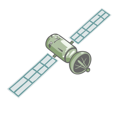
Formally speaking, a satellite is a body that orbits another body in space. Hence, the moon is for example a satellite to the Earth. However, usually when we talk about satellites we are considering human-made objects that are orbiting the Earth or other bodies in space and this is the way we will use the word satellites also here. The satellites that are relevant for agtech purposes are human-made satellites that are orbiting the Earth, and where the altitude, inclination, and shape of the orbit is dependent on the purpose of the satellite.
Even if the details about the orbits are not that interesting to us at the moment, we can note that the satellites and orbits are categorized by the altitude at which they orbit Earth. A satellite with an orbit at a maximum altitude of 2 000 km is called a Low Earth Orbit satellite, a satellite with an altitude of 2 000 to 35 786 km is called a Medium Earth Orbit satellite, and a satellite that orbits at an altitude of more than 35 786 km is called a High Earth Orbit satellite. A special case arise when the satellite orbits at 35 786 km along the equator, since then it orbits at the exact same speed as the Earth is rotating with the consequence that it is fixed above a certain point on the equator. These are called Geostationary Earth Orbit satellites. There exists many other types of orbits as well, but let’s not go into more details about this here since it is enough for us to keep in mind that different satellites have different orbits that are dependent on the particular purpose or use-case for that satellite.
What do satellites measure and how often to they do it?
Basically a satellite consists of a sensor coupled with a power supply and a communication system. This is of course very simplified, but for the purpose of understanding how they can help us in crop farming this is good enough. For far-field sensing, that is collecting data with sensors far away, in crop farming mainly two types of sensors are interesting: multi-spectral cameras and radar sensors.
A multi-spectral camera is similar to a regular camera where pixels in a photo sensor measures how much light of a certain type that shines on the pixel. In a regular camera, such as the one in you smartphone, each pixel measures the amount of red, green, and blue light that shines on the pixel (hence the name RGB camera). We say that it can measure three spectral bands. A multi-spectral camera can measure even more an these three types of light, and exactly what spectral bands it measures depends on the type of sensor and its specifications. Common types of lights, or spectral bands, that are measured are infrared light (IR), and near-infrared light (NIR).
A radar sensor is on the other hand an active sensor, meaning that it transmits a radar pulse towards the Earth, that bounces off the surface and is then measured by the sensor. Depending on how the signal bounces back, information about for example the soil moisture, the elevation, or the height of trees and buildings can be measured. By performing several measurements with the radar sensor in the satellite while it is moving in its orbit, a high-resolution radar image of the ground can be created using a so called Synthetic Aperture Radar (SAR) technology. We will look more into this in a later Agtech Letter and skip the details here.
How often the satellite can measure a position on the Earth, that is the temporal resolution, is dependent on the orbit and how many satellites that are measuring the same thing since two or more satellites working together can “take turns” measuring at a certain position. Similarly, the spatial resolution is dependent on the sensor specifications and the orbit and together they determine how large area of the ground that is covered by a single pixel in the sensor. Common resolutions for crop monitoring satellites are somewhere between 1-2 measurements per week to a couple of times per day, with a spatial resolution of 100 x 100 meters to sub-meter resolution. Usually, higher resolution in time and or space comes with a higher price for the satellite image.
Satellites used in agriculture
Satellites that are used for far-field sensing of crops and fields are usually of a Low Earth Orbit type and are put into a sun-synchronous orbit. The fact that they are sun-synchronous means that they pass a specific point on the Earth at approximately the same time each time, which is a very good thing for satellites that are used for capturing images or performing measurements that are dependent on the sunlight. By capturing images/measuring at the same time for each position every time, the effects of different lighting conditions are minimized and makes it easier to compare measurements between two different days.
Examples of satellites that are used for far-field sensing in agriculture are the European Sentinel and Pleiades satellites, the American Landsat satellites, and satellites provided by private companies such as Planet.
Two other types of satellites that are important for agriculture are weather satellites and satellites for global navigation satellite systems (GNSS). Weather satellites are often put into a geostationary orbit above the equator since then they can monitor the weather from the exact same spot all the time. Sometimes they are instead put into a sun-synchronous polar orbits to cover the areas around the North and South poles.
The most well-known GNSS system is the American Global Positioning System (GPS), and these satellites are put into a Medium Earth Orbit at approximately 20 000 km in altitude and rotates around the Earth in a way that they pass the exact same position above the Earth two times each 24 hours, which simplifies the positioning.
To use the satellite image, you don’t need to know all the details about satellites and orbits, but it can be good to understand that the different satellites have different properties and possibilities due to different orbits and sensors. It’s coming more services that are based on satellite monitoring of fields, and it can be good to understand what satellites they are collecting data from and what resolution that data have.
Agtechers' Actions
Satellites are used to many things already today, and the potential use-cases for them in agriculture are many. Often they are quite cheap and don’t require any investments in hardware, and hence its good to be curious and investigate what solutions there are.
In the next Agtech Letter we will look into how multi-spectral images from satellites can be used in practice to measure different parameters of the crop and the field.


